Northern Stream Carr Survey
Introduction
| This report gives the results of a descriptive plant
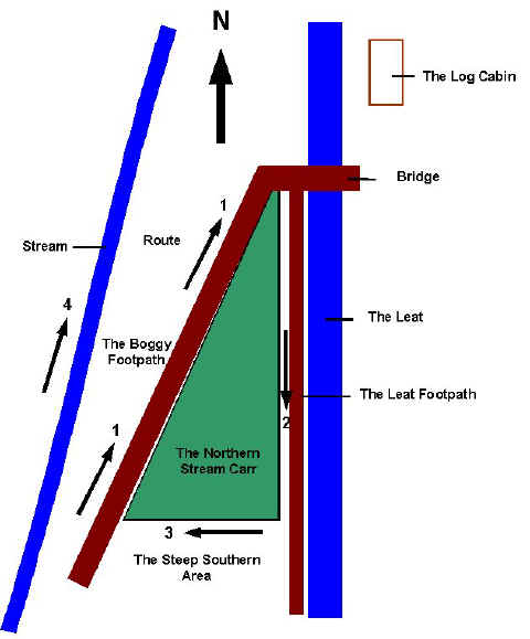
survey of a small wet woodland in the Woodland Education Centre (map).
The survey was carried out in October 2001. Four different areas were identified
within this small wet woodland. The report describes the areas and gives plant
species lists for three of them. These illustrate the types of plants which may be
found in a wet woodland in South West England. A carr is a type of woodland which develops on wet land. Typically this happens at the edge of wetlands where sediment is being trapped by wetland plants.This has the effect of raising the land above the water level to the point where tree seedlings can develop and survive. Trees that can tolerate such conditions include Alder (Alnus) and Willow (Salix). The Northern Stream Carr was originally dominated by non-native rhododendron. The rhododendron has been cleared and controlled, beginning in 1990. At that time the only plants to have survived among the thick rhododendron cover were many tall, thin willow, alder, oak and birch trees.
Follow the route marked on the diagram. Boggy Footpath description and species list here.
|