| This paged has moved. You will be redirected to the new page
automatically in 3 seconds. Please bookmark the correct new page at www.countrysideinfo.co.uk
|
FIRE BEACON HILL
Map Ref : SY 112 908 (Trig point at 734')
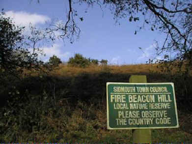 |
Fire Beacon Hill is an area of Lowland Heath situated 5km north of Sidmouth and 2 km north-west of Sidford at the southern most end of East Hill. East Hill is a prominent ridge over looking the fertile Otter valley. left: The approach to Fire Beacon Hill heathland. |
Location
The reserve comprises 26.39 ha of dry acidic, lowland heath; acidic grassland and bracken
with secondary woodland. The planning authorities are Devon County Council and East
Devon District Council. Fire Beacon Hill lies in the parish of Sidmouth.
Summary Description.
Fire Beacon Hill lies at the southern end of East Hill, a south-west to north-east running
ridge which has a capping of clay-with-flints and chert overlying Cretaceous Upper
Greensand. This geology is characteristic of the hills in East Devon and often supports
similar areas of Lowland Heath.
The triangular site is bounded by to the west by a conifer plantation, to the east by
mature deciduous woodland and to the south by farmland.
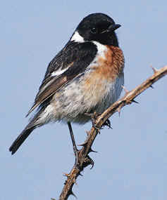 |
left: Stonechats favour areas such as heathland. Photo courtesy RSPB |
Several nationally uncommon species occur on the heath including the Grayling butterfly,
and breeding Stonechat, Dartford Warbler
and Nightjar.
Recent management has included tree planting (prior to 1992), with bracken control
(rolling, scraping and spraying), gorse coppicing and firebreak creation after 1992.
Land Tenure
Sidmouth Town Council have been the freehold owners of the land since 1980. An
agreement between the Town Council and East Devon District Council was signed in 1992
declaring the site to be a Local Nature Reserve. The Town Council are responsible for the
management of the reserve.
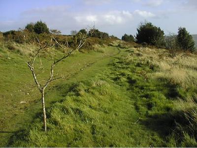 |
left: on top of Fire Beacon. |
Physical
Fire Beacon Hill is part of the East Devon dissected plateau, comprising calcareous Upper
Greensand capped by clay-with-flints and chert (in part Eocene) and overlying Keuper
Marls.
The northern part of the site is 225m above sea level and is relatively flat but the ground slopes steeply to the south down to 150m.
Diversity
The site is relatively diverse given its small size. Approximately 12.66 ha is Lowland
Heath, 3.92 ha bracken and acidic grassland, 6.71 ha bracken and invasive trees, and 3.10
ha woodland. However species diversity is relatively low although nationally important.
Species present in the tetrad that includes the reserve have been included in the following publications:
1939 Flora of Devon
1984 Atlas of Devon Flora
1988 Tetrad Atlas of the Breeding Birds of Devon
1992 National Nightjar Survey (surveyor D Marks)
1993 Devon Butterflies
1994 National Dartford Warbler Survey (surveyor P Gotham)