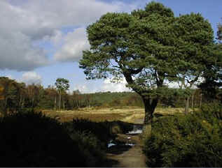
Lowland Heath - Historical Background
 Lowland heaths in England are designated as Historic Landscapes. Heath-type vegetation has
existed in Britain in varying quantities and form for the past 14,000 years.
Lowland heaths in England are designated as Historic Landscapes. Heath-type vegetation has
existed in Britain in varying quantities and form for the past 14,000 years.
We know this from the study of identifiable pollen grains preserved in sediments (palynology). Radio-Carbon dating allows accurate dating of the sediments and this together with ancient written records has allowed a picture of historical vegetation changes in Britain to be constructed.
Approximately 14,000 years ago, the ice sheets which covered much of Britain in the Ice Age, retreated. As the climate warmed sufficiently, a tundra-type vegetation, which included Heather, became established.
Between 10,000 and 6,000 BP (Before Present) the climate warmed further, allowing trees to become established and much of Britain became wooded. Over this period, heather may have survived only in open glades or on woodland margins where there was sufficient light for growth.
Around 5,000 years ago in Britain, in Neolithic times, Man began domesticating plants and animals and agriculture was born.This coincided with a reduction in the amount of tree pollen and an increase in the amount of Heather pollen recovered from sediments of this age. It has been concluded that heathlands resulted from increasing levels of agricultural activity dating from this period. This may have come about through gradual clearance of existing woodland for planting crops. Once the soil nutrients were exhausted and people moved on to cultivate a new area, grazing (whether of domestic or wild animals) may have prevented the re-establishment of trees and favoured the development of heathland. Certainly by the Bronze Age (ca 3,000 BP),heathlands were well-established over large areas of England.
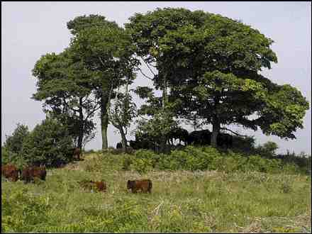
Forest clearance continued up to the 17th Century. Human settlements were usually on areas of more fertile ground, adjacent to the barren heaths. The heathland was utilized for what it could provide. Gorse tops were cut for fodder for animals, while the older parts provided fuel. Trees were also cut for fuel and Bracken was gathered for animal bedding, as fuel and also to provide potash for industries such as glass and soap-making. Domestic animals were grazed on the heath and turf and peat were cut for fuel(turbary). Grazing and turbary rights were often jealously guarded commodities. All of these activities served to maintain the open nature of the heath and prevent its reversion to woodland.
Decline of Heathland
Prior to the 17th Century, the technology to allow agricultural improvement of barren land was simply not available. By the 18th Century, new technology began to be developed which allowed reclamation of "waste areas". Such activity was seen to be highly desirable and was greatly applauded. The enclosure of common lands by the authority of Acts of Parliament in the 17th and 18th Centuries led to the development of field systems and an increase in arable farming. This heralded the beginning of a dramatic decline in heathland areas.
This decline accelerated with the advent of cheap and easy transportation in the 19th Century. People were no longer forced to rely on local resources and the traditional activities which had maintained the heathland structure were no longer carried out. As a result, many heathland areas reverted to woodland.
Increasing use of technology to reclaim infertile areas for agriculture and forestry, large-scale mechanical extraction of sand and gravel and urban encroachment have all played a role in the decline of heathlands. Of the heathlands present in 1800, 82% have now disappeared.
Within East Devon, of the heathlands present in 1936, over 75% have now been lost. Large declines have occurred throughout the district and many areas have lost almost 100% of their heathland since 1936 (attributable to East Devon Biodiversity Action Plan (EDBAP) produced by Devon Wildlife Trust, on behalf of East Devon District Council).
These losses have resulted not only in loss of available habitat, but also to increasing fragmentation and isolation of remant sites. Within Devon, most of the remaining fragments are less than 50 ha in area. Only 3 sites cover more than 50 ha (EDBAP).99
Lowland Heaths in East Devon
This website is hosted by the Offwell Woodland & Wildlife Trust and managed by Quartz Productions