Offwell Woodland & Wildlife Trust

Promoting the British Countryside

Home

About us Conservation Education Wildlife Habitats Maps Search Resources Sponsors


The Wet Woodland Plant Survey

Area Map

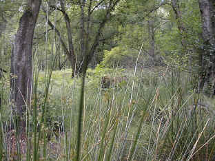
The Wet Woodland incorporates six distinct areas of plant diversity within the Husk.  The Husk is sited on the western edge of the Woodland Education Centre, adjacent to The Heathland Area.  It is an area of mature deciduous woodland situated on a south-east facing slope.  The soil is mainly acid.   A fairly narrow channel of bog/marsh called The Seepage runs downhill through the centre of the Husk.  Adjacent to this on either side are transition zones leading to drier areas.  North and west of the Seepage the tree canopy is quite thick and more mature, while to the south it is more open and the ground is littered with chert stones and flints.

Image21.jpg (792156 bytes)
The Seepage


map.jpg (39924 bytes)

The diagrammatic map above is not drawn to scale.

Where is the Wet Woodland? 
(This link will open in a new window.  You will need to return to this window to continue browsing the Wet Woodland Survey.)
Back to the Contents Page


Copyright © Offwell Woodland & Wildlife Trust 1998/9 & 2000/1/2/3/4 http://www.offwell.info

All the information including images, charts, movies and sounds is provided copyright free, only for educational use by: schools, colleges and universities unless you are making a charge. If you wish to use information or any part of this site for commercial purposes or for any purpose where a charge is made then you must get permission, so make sure you contact us first. Remember, if you are not a school, college or university you must obtain permission to use any part of this website. Note that company logos are reproduced with permission and remain copyright of their respective owners.